Wildland Fires & Smoke
Wildland Fires & Smoke
According to the EPA, a wildland fire is any fire that occurs in an area where there is little to no human activity or development. These areas can include forests, shrublands, grasslands, or wetlands.
Wildland fires include:
- Wildfires, which are unplanned and can be started naturally – such as by lighting or volcanoes – or through accidental or unauthorized actions by humans.
- Prescribed fires, which are planned fires ignited by experts that are used for several beneficial objectives, including reducing fuels to limit the size of future wildfires.
Health Impacts
While everyone can be impacted by wildland fire smoke, healthy people are usually not at a major risk from wildland fire smoke. However, people with heart or lung disease, older adults, children and teenagers, and people who are more likely to be exposed are at increased risk of experiencing health effects. If you are at increased risk from wildland fire smoke, you are also at increased risk from extreme heat. Symptoms may include burning eyes, runny nose, and illnesses such as bronchitis.
Learn more about the health effects of wildfire smoke and how to protect yourself on CDC's Wildfire resource page.
Austin Expands Area at Risk of Wildfire
In April 2025, the City of Austin's City Council adopted a map that puts just over half of all habitable land in the city at risk of being destroyed in a wildfire, according to KUT News. The Council's vote comes amid growing concern over wildfires in Central Texas. In mid-March of 2025, a fire burned nearly 10,000 acres just north of Fredericksburg, with smoke traveling east, darkening skies, and degrading Austin's air quality.
The map’s expansion is largely due to decisions by the fire department to put more of the city into Zone C. Fire officials cited studies showing how far embers from a fire can travel, igniting roofs or other parts of homes.
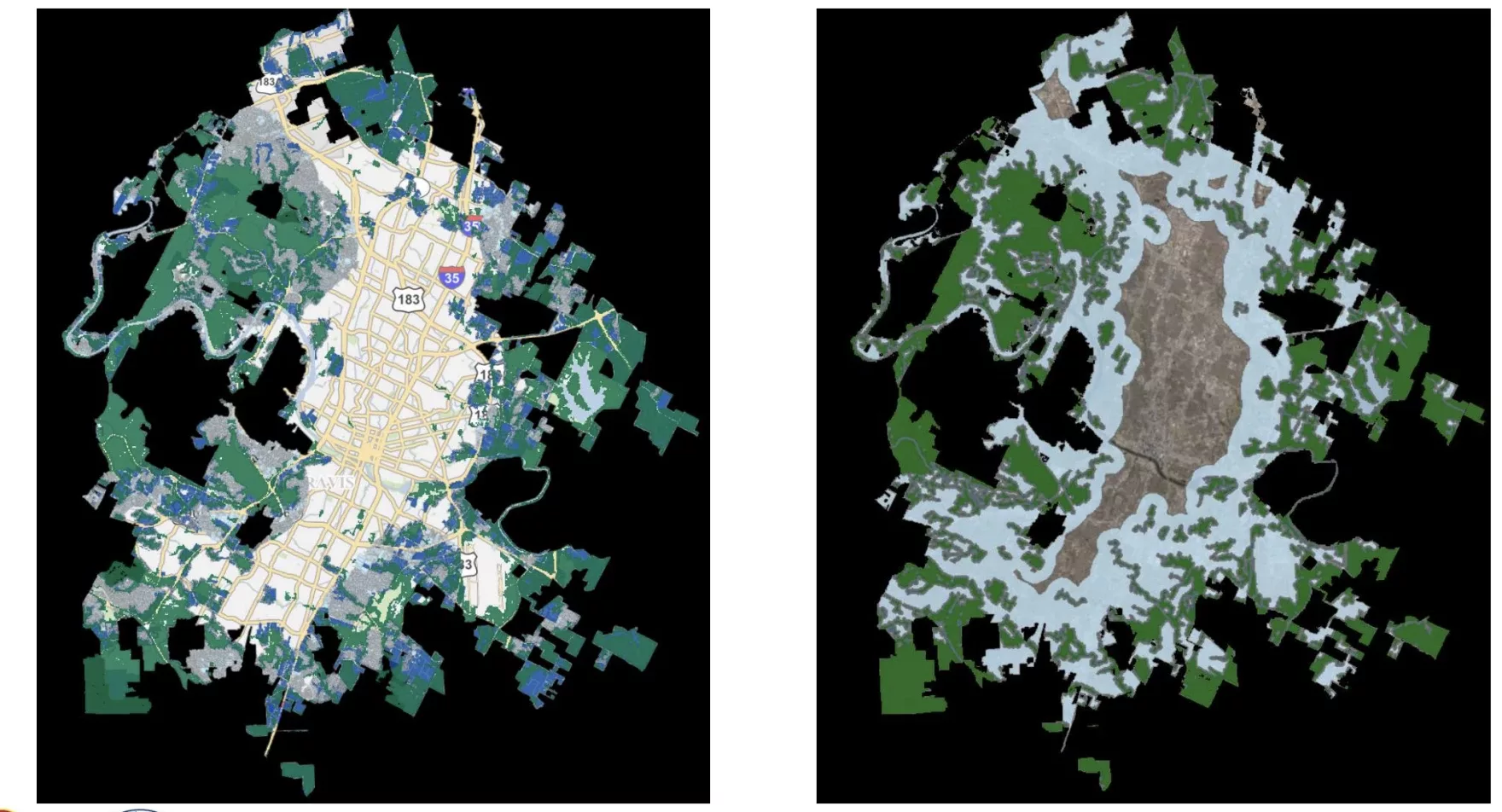
On the left is Austin's first wildfire risk map, adopted in 2018. On the right is the map adopted in 2025. The blue and green areas denote risk zones (KUT News/City of Austin).
AirNow Fire & Smoke Map
AirNow is your one-stop source for air quality data. The AirNow site highlights air quality in your local area first, and also provides air quality information at state and national views.
AirNow's data provides high-quality information that is reported by partners in a consistent format. It is available to the public, researchers, businesses, educators, and to other data systems.
EPA and the U.S. Forest Service have developed the AirNow Fire and Smoke Map to provide the public information on fire locations, smoke plumes, near real-time air quality and protective actions to take—all in one place.
You can view the Fire and Smoke Map at https://fire.airnow.gov/ or in the AirNow mobile app. To view the map in Spanish, click or tap the globe icon at the top of the map, and select Español.
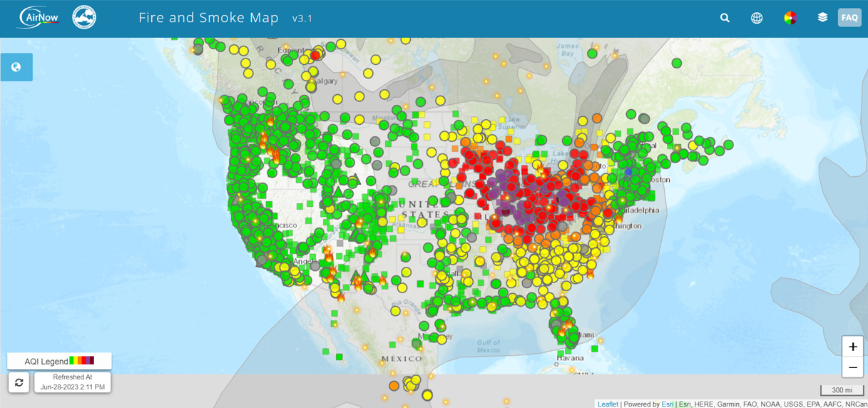
Screenshot of the EPA's AirNow Fire and Smoke Map tool (EPA).
Texas A&M Forest Service: Wildfires and Disasters
The Texas A&M Forest Service is one of the lead agencies for incident management in the state. They host the Wildfires & Disasters resource page, which provides daily updates on active wildfires, contained wildfires, and the posted Wildland Fire Preparedness Level, which are planning assumptions and actions dictated by fuel and weather conditions, current and expected wildfire activity, regional preparedness levels and fire suppression resource availability in state.